**Major Winter Storm to Impact Parts of America: What You Need to Know**
Parts of America are bracing for more wintry weather as gusty winds up to 100 mph and as much as 2 feet of snow are expected in certain regions starting Wednesday, with snowfall lingering in some areas until Friday afternoon. The National Weather Service (NWS) has issued winter weather alerts for three states.
—
**Why It Matters**
Heavy snow and blustery winds are forecasted to cause significant travel disruptions. The NWS warns that some roads could become “impassable,” urging drivers to slow down—especially during morning and evening commutes. Thick snow and strong winds may also bring down tree branches and damage power lines, resulting in potential power outages.
—
**Where Are the Winter Weather Advisories?**
The NWS has issued advisories for:
– **New York**
– **Nevada**
– **Northeastern California**
—
**State-by-State Breakdown**
**New York**
– **Niagara and Orleans counties** should prepare for lake-effect snow, which can cause highly variable weather conditions. Some areas could see up to 3 inches of additional snow by Wednesday morning, but the snow is expected to turn to rain later in the day.
– **Eastern Lake Ontario region:** Up to 6 inches of snow is possible for the hardest-hit areas, particularly on the Tug Hill Plateau and through Jefferson County. Snow will likely switch to rain by Wednesday afternoon at lower elevations.
– **Northern Erie County:** Up to 3 inches of snow is possible through Wednesday morning. Brief periods of moderate snow may affect the Buffalo Metro area and the Northtowns before precipitation turns to rain.
**Nevada**
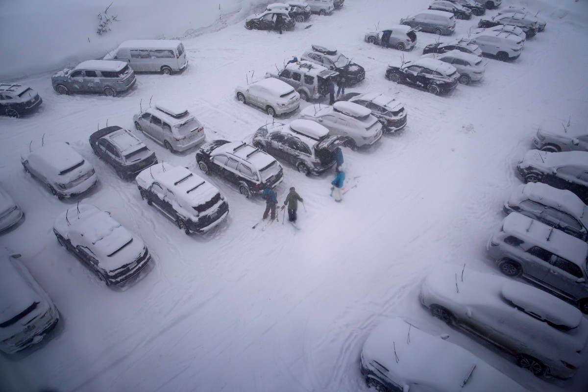
– In the **Greater Lake Tahoe Area** above 7,000 feet, up to 10 inches of snow is expected, and the Sierra Crest could see 8 to 16 inches from Thursday morning until Friday afternoon, with ridge winds possibly exceeding 100 mph.
– **Lake Tahoe** may experience winds up to 40 mph, creating waves as high as 4 feet.
– The NWS warns that travel could be “very difficult,” especially across Donner, Carson, and Ebbetts mountain passes.
– In the **West Slope Northern Sierra** above 6,500 feet, up to 8 inches of snow is possible by Friday afternoon, with the highest areas south of Highway 50 potentially seeing up to 2 feet of snow and wind gusts up to 50 mph.
**Northeastern California**
– **Lassen, Eastern Plumas, and Eastern Sierra counties** could receive 4 to 8 inches of snow above 5,550 feet and face winds up to 70 mph along the ridges from Thursday morning through Friday afternoon. Travel may be difficult along mountain passes northwest of Bogard.
– **Western Plumas and Lassen Park** could see winds up to 50 mph and 3 to 8 inches of snow above 6,500 feet, with the highest peaks south of Highway 50 potentially getting up to 2 feet of snow from Thursday morning until Friday afternoon.
—
**What Officials Are Saying**
On X (formerly Twitter), the New York NWS stated:
“Scattered snow showers are expected across the area through this afternoon. This may result in some minor snow accumulations on cooler surfaces. In addition, gusty winds combined with the snow showers may result in briefly reduced visibility.”
—
**What Happens Next?**
The NWS predicts that snowfall will likely transition into rain in some areas—particularly in New York—as Wednesday progresses. Residents and travelers in all affected regions are urged to stay tuned to local forecasts for the latest updates and safety information.
Be prepared for hazardous road conditions, possible power outages, and rapidly changing weather. Follow all advisories and take precautions as the storm moves through your area.
https://www.newsweek.com/winter-storm-warning-as-2-feet-of-snow-to-hit-11032128